GEODESY SERVICES

The foundation of planning tasks relies heavily on high-quality geodetic work. Over the years, our company has built up a geodetic team and established a subsidiary specializing in geodesy, the Mért Pont Surveying and Engineering Office. The primary task of these geodetic units is to perform comprehensive geodetic work necessary for our company’s planning tasks.
Our geodetic activities include:
- Establishment of base points
- Preparation of planning maps
- Geodetic tasks for construction execution
- Bridge inspection measurements
- Various types of surveys and control measurements
- Setting out tasks
- Preparation of expropriation plans
- Land consolidation tasks
Naturally, our geodetic units also undertake tasks for external orders. We continuously work for contractors, but we also regularly provide services to other planners and organizations.
Some of our main contracting partners for execution-related work include:/p>
- Betonút Zrt.
- Strabag Zrt.
- Vegyépszer Zrt.
- M6 Építési Kkt.
Among our geodesy professionals, we have:
- 6 geodetic engineers
- 2 geodetic technicians
- Additional fieldworkers
With this team of experts, 6-8 field teams can work simultaneously, and several of them can also handle office tasks.
To ensure high-quality work, our company always utilizes the most modern equipment and tools.
Our own equipment includes:
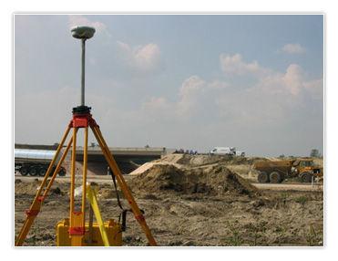
- GPS: Trimble R7 – R8 RTK kits
The technology based on dual-frequency satellite positioning systems is now used for all basic network tasks, and in open terrain, it is also utilized for detailed surveys and setting out tasks, representing the most advanced measuring system.
- Trimble GX 3D Laser Scanner
The most advanced digital surveying technology. Currently, it is the only laser scanner capable of geodetic tasks (detailed description available separately on the website). - Intelligent measuring stations and their accessories: complete measurement systems.
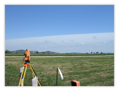
(Geodimeter 510, Geodimeter 608 robot, Trimble 5602, Trimble S6 robotic total stations with Autolock, Trimble 5503) It is worth noting that the S6 and Trimble 5602 instruments are capable of measuring with an accuracy of 2 seconds.
For surveys involving a large quantity of road surfaces, especially cross-sectional pavements, the simultaneous work of a survey team equipped with three robotic instruments is efficient.
For various detailed surveying tasks, we employ surveying techniques developed by our company and aligned with our equipment, ensuring speed, accuracy, and integration with the planning process.
- Leveling: Trimble DiNi 12t, Leica 724 leveling instruments
For highly accurate elevation determinations, the Trimble DiNi 12t digital level instrument enables extremely fast and error-free work, meeting the requirements of higher-order leveling. The Leica 724 automatic levels are excellent assistants for lower geodetic tasks. - Traditional surveying instruments (prisms, measuring tapes, etc.), supplementary tools (e.g., transmitters-receivers)
- Vehicles: off-road vehicles, vans, cars
- Hardware (PCs, laptops, peripherals). Laptops are necessary for fieldwork requiring computational and software support.
- Software: Sector-specific – ITR, AutoCAD, MX, Office applications – MS Office
Equipping additional survey teams for larger projects involves providing complete surveying equipment (total stations, levels, traditional surveying instruments) and office infrastructure.
The cornerstone of our design tasks is high-quality geodetic work. Over the years, our company has built a geodetic team and established a subsidiary specializing in geodesy, called Mért Pont Földmérő és Mérnöki Iroda. The primary task of these geodetic units is to perform comprehensive geodetic work necessary for our company’s design tasks.

